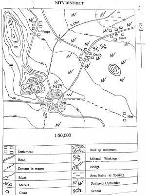
The highest elevation in the mapped area is approximately
800 m
900 m
1250 m
1400 m
Correct answer is C
No explanation has been provided for this answer.
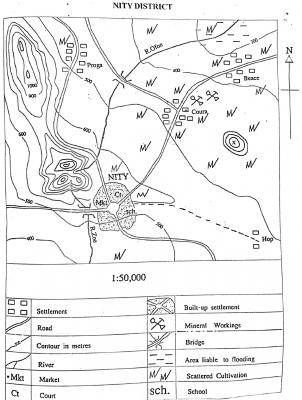
Which of the following settlements is nodal?
Beace
Hop
Proga
NITY
Correct answer is D
No explanation has been provided for this answer.
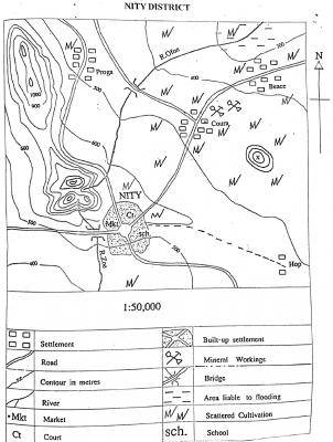
The approximate length of R. Ofon is
18.3 km
16.5 km
6.6 km
3.0 km
Correct answer is A
No explanation has been provided for this answer.
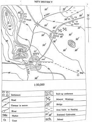
What is the scale of the map in statement form?
one centimeter on the map represents half kilometer on the ground
One centimeter on the map represents one kilometer on the ground.
One centimeter on the map represents five kilometers on the ground
One centimeter on the map represents fifteen kilometers on the ground.
Correct answer is A
No explanation has been provided for this answer.
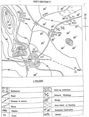
What is the contour interval of the map?
50 m
100 m
150 m
400 m
Correct answer is B
No explanation has been provided for this answer.
WAEC Subjects
Aptitude Tests