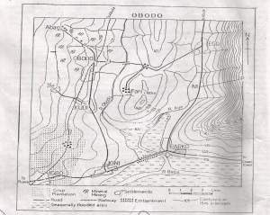
Col
Pass
Road gap
Wind
Spur
Correct answer is A
No explanation has been provided for this answer.
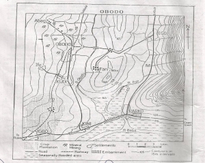
The length of the railway line shown on obodo map is
13.75km
16.75km
19.75km
22.75km
25.75km
Correct answer is A
No explanation has been provided for this answer.
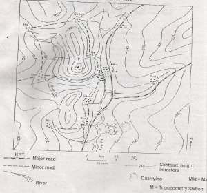
What is the average gradient of the slope marked G-H?
1:32
1:34
1:36
1:38
1:40
Correct answer is A
No explanation has been provided for this answer.
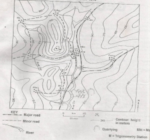
What is the size, in square kilometres of the area covered by the map?
64.0 sq.km
62.0 sq.km
58.0 sq.km
55.0 sq.km
51.0 sq.km
Correct answer is C
No explanation has been provided for this answer.
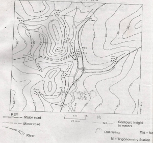
Name the feature crossed by the footpath between points Y and Z
Spur
Wind gap
Gorge
Dry valley
Ridge
Correct answer is D
No explanation has been provided for this answer.
JAMB Subjects
Aptitude Tests