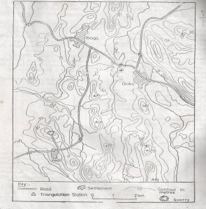
The landform between River Oni and the Kedi-Ibaga road is a
Rolling plain
Broken ridge
Cuesta
Fault-scarp
Correct answer is B
No explanation has been provided for this answer.
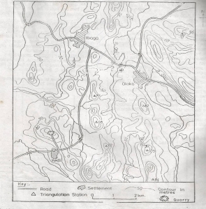
The settlements pattern is BEST described as
Nucleated
Dispersed
Linear
Nodal
Correct answer is D
No explanation has been provided for this answer.
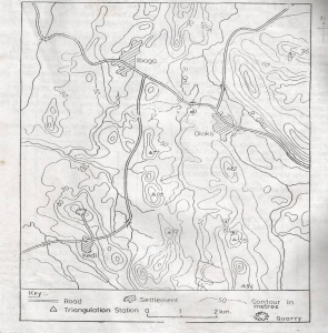
The settlements in the area mapped are located mainly on the
Flood plains
Ridge tops
Footslopes
Valley floors
Correct answer is C
No explanation has been provided for this answer.
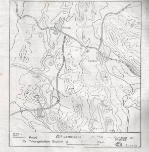
Which of these triangulation stations is NOT visible from the edge of the quarry?
82
94
96
105
Correct answer is D
No explanation has been provided for this answer.
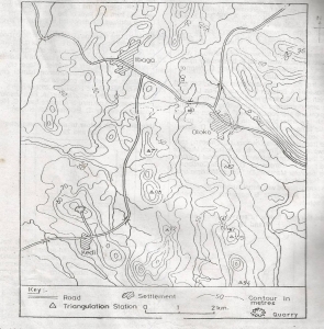
The highest point above mean sea level in the region is just above
100m
110m
120m
130m
Correct answer is A
No explanation has been provided for this answer.
JAMB Subjects
Aptitude Tests