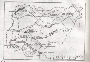
The shaded area labelled Z on the map indicates the part of Nigeria that suffers most from
River blindness
Tse-tse fly infestation
Drought and desertification.
Toxic waste pollution
Correct answer is C
No explanation has been provided for this answer.
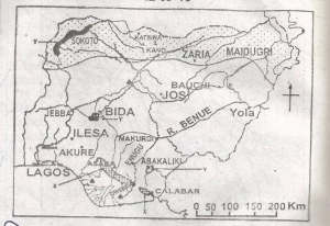
The River marked R is the River
Gongola
Yobe
Gurara
Taraba
Correct answer is A
No explanation has been provided for this answer.
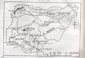
The shaded areas labelled X on the map indicate the probable areas of the occurrence of
Phosphate
Natural gas
Marble
Lignite
Correct answer is D
No explanation has been provided for this answer.
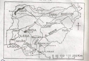
The shaded areas labelled Y on the map are noted for
Dry season wheat cultivation
Floodland rice cultivation
Large-scale fish farming
Large-scale irrigation farming
Correct answer is B
No explanation has been provided for this answer.
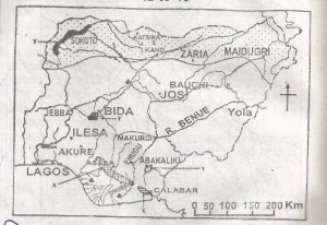
The point marked with solid triangles are the locations of Nigeria's
Thermal power stations
International airports
Automobile assembly
Oil refineries
Correct answer is D
No explanation has been provided for this answer.
JAMB Subjects
Aptitude Tests